|
| Mesoscale Discussion 1390 |
|
< Previous MD Next MD >
|
|
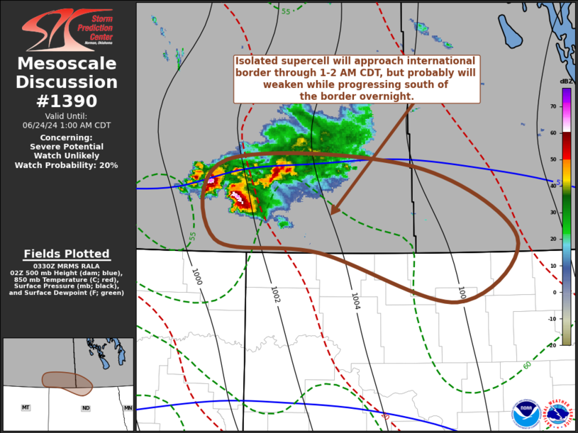
   Mesoscale Discussion 1390
   NWS Storm Prediction Center Norman OK
   1032 PM CDT Sun Jun 23 2024

   Areas affected...parts of north central North Dakota

   Concerning...Severe potential...Watch unlikely

   Valid 240332Z - 240600Z

   Probability of Watch Issuance...20 percent

   SUMMARY...Lingering isolated supercell development may approach the
   north central North Dakota international border area by 1-2 AM CDT,
   accompanied by continuing risk for large hail and locally strong
   surface gusts.  But it seems probable that this activity will tend
   to weaken as it progresses south of the border overnight.

   DISCUSSION...The southernmost cell of an initial cluster of
   supercells over southern Saskatchewan has been maintaining
   considerable strength while steadily propagating east-southeastward
   within strongly sheared 35-40 kt west-southwesterly deep-layer mean
   flow.  It appears that this is being supported be seasonably moist
   updraft inflow, rooted within large-scale ascent associated with
   low-level warm advection, above a stable boundary layer to the east
   of the lee surface trough, but still characterized by CAPE on the
   order of 1000-2000+ J/kg.

   Based on its current motion, it would begin propagating across the
   international border to the north of Minot by 06-07Z.  However, the
   northern/northeastern periphery of a plume very warm and more
   strongly capping elevated mixed-layer air is also in the process of
   advecting across this region, downstream of a mid/upper trough
   progressing across the Canadian Rockies into the Canadian Prairies.
   This may tend to finally suppress any stronger convection attempting
   to cross the international border.

   ..Kerr/Gleason.. 06/24/2024

   ...Please see www.spc.noaa.gov for graphic product...

   ATTN...WFO...BIS...

   LAT...LON   49960439 49890138 49159975 48470071 49000288 49130456
               49960439
|
|
Top/All Mesoscale Discussions/Forecast Products/Home
|
|


 @NWSSPC