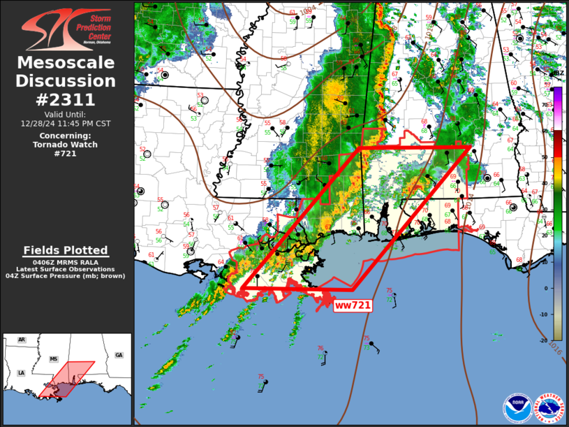
   Mesoscale Discussion 2311
   NWS Storm Prediction Center Norman OK
   1008 PM CST Sat Dec 28 2024

   Areas affected...Southeast Louisiana to southern Alabama

   Concerning...Tornado Watch 721...

   Valid 290408Z - 290545Z

   The severe weather threat for Tornado Watch 721 continues.

   SUMMARY...Isolated damaging winds, along with some tornado risk,
   continues.

   DISCUSSION...Southern flank of an elongated MCS is advancing slowly
   east across western portions of ww721. Gusty winds are likely
   occurring along the leading squall line, but this activity is more
   fragmented than areas farther north, and most reports have been
   sub-severe. Even so, warm advection profiles are more than
   adequately sheared for maintaining organized convection, and even
   supercells. Some risk for tornadoes continues, especially with
   pre-squall line supercells.

   ..Darrow.. 12/29/2024

   ...Please see www.spc.noaa.gov for graphic product...

   ATTN...WFO...BMX...MOB...JAN...LIX...

   LAT...LON   29349097 31948850 31948610 29338865 29349097
|


 @NWSSPC