|
| Mesoscale Discussion 2314 |
|
< Previous MD Next MD >
|

|
   Mesoscale Discussion 2314
   NWS Storm Prediction Center Norman OK
   0306 AM CST Sun Dec 29 2024

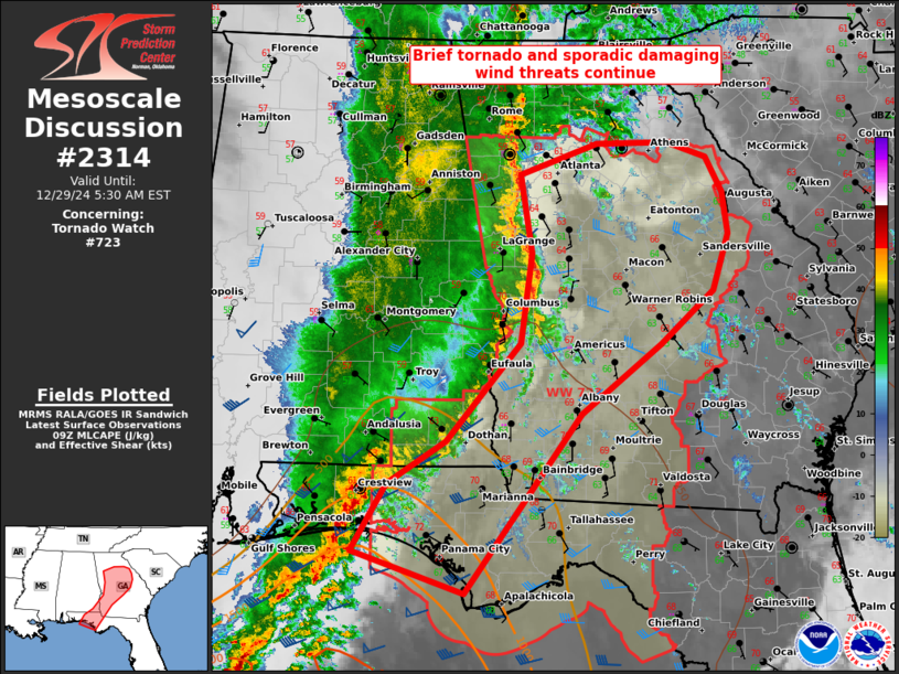
   Areas affected...parts of GA to the FL Panhandle

   Concerning...Tornado Watch 723...

   Valid 290906Z - 291030Z

   The severe weather threat for Tornado Watch 723 continues.

   SUMMARY...Potential for brief tornadoes and sporadic damaging winds
   from strong gusts should persist through sunrise as a QLCS
   progresses across Georgia and the Florida Panhandle.

   DISCUSSION...Overall severe potential has subdued slightly in the
   early morning hours as the faster-moving/north-south oriented
   portion of the QLCS spread into GA from AL. Despite the presence of
   a 60-kt rear inflow jet per the MXX and EOX VWP data, measured
   surface gusts have largely ranged from 40-55 mph. The forward motion
   of this line at around 45 kts appears to be outpacing MLCAPE in
   excess of 500 J/kg. Still, low to mid 60s surface dew points have
   become common across central GA and will support scant to meager
   buoyancy downstream. This should be sufficient for a sporadic wind
   damage and brief tornado threat given the strong low-level
   winds/SRH.

   The trailing portion of the QLCS in the western FL Panhandle has
   been steadily moving east at around 25 kts, lagging well behind the
   west-central GA portion. Rich low-level moisture combined with
   sufficient shear will support potential for tornadogenesis and
   occasional strong gusts. These threats may tend to be focused near
   the coast where inflection in the large-scale convective outflow is
   maintained.

   ..Grams.. 12/29/2024

   ...Please see www.spc.noaa.gov for graphic product...

   ATTN...WFO...CAE...FFC...TAE...BMX...MOB...

   LAT...LON   30208662 30838623 31228559 32158479 32988467 33738480
               34028395 34028316 33898273 33558256 33168249 32638267
               32148325 31488411 29808538 30208662
|
|
Top/All Mesoscale Discussions/Forecast Products/Home
|
|


