|
| Mesoscale Discussion 2315 |
|
< Previous MD Next MD >
|

|
   Mesoscale Discussion 2315
   NWS Storm Prediction Center Norman OK
   0422 AM CST Sun Dec 29 2024

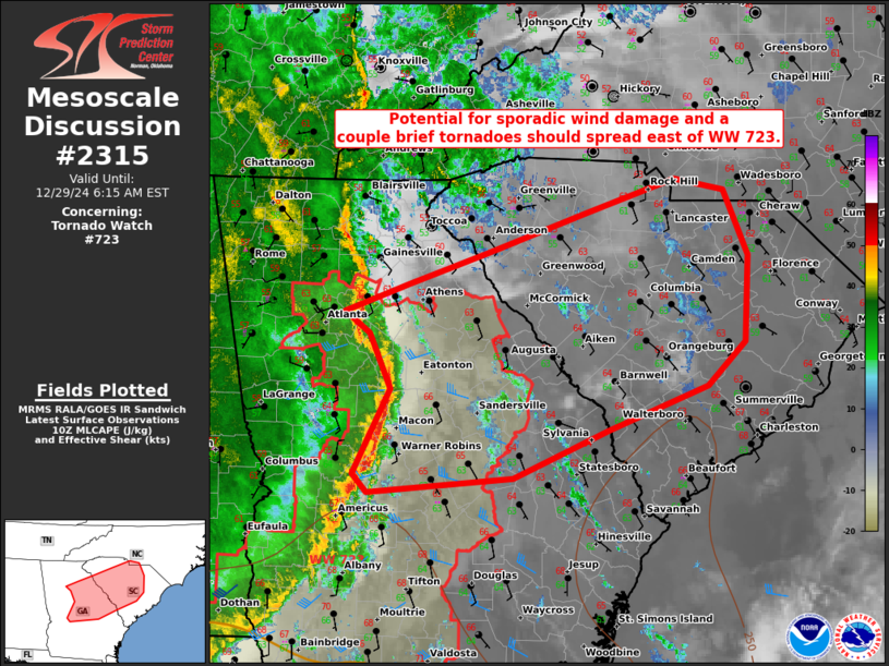
   Areas affected...parts of eastern GA and SC

   Concerning...Tornado Watch 723...

   Valid 291022Z - 291115Z

   The severe weather threat for Tornado Watch 723 continues.

   SUMMARY...Northern portion of extensive QLCS should continue to move
   more quickly east and out of WW 723 into parts of eastern Georgia
   and South Carolina by sunrise. Sporadic damaging winds along with a
   couple brief tornadoes should remain possible. A downstream tornado
   watch will likely be coordinated within the hour.

   DISCUSSION...The northern portion of the Deep South QLCS has more
   rapidly progressed eastward from 40-45 kts across central GA.
   Downstream air mass is characterized by scant MLCAPE below 250 J/kg,
   amid weak tropospheric lapse rates but 62-64 F surface dew points.
   Thermodynamics are unlikely to appreciably improve over the next 3-4
   hours. Still, the organized nature of the QLCS along with continued
   very strong low-level wind fields will support potential for a few
   transient mesovortices. A couple brief tornadoes and damaging gusts
   from 45-60 mph should remain possible through the mid to late
   morning.

   ..Grams/Edwards.. 12/29/2024

   ...Please see www.spc.noaa.gov for graphic product...

   ATTN...WFO...RAH...ILM...CHS...CAE...GSP...FFC...

   LAT...LON   32408242 32288392 32438408 33188370 33658391 33858418
               34098352 34358272 34728165 35008075 34918023 34337999
               33588003 33218041 32828143 32408242
|
|
Top/All Mesoscale Discussions/Forecast Products/Home
|
|


