Note:
The expiration time in the watch graphic is amended if the watch is
replaced, cancelled or extended.
Note:
Note:
The expiration time in the watch graphic is amended if the watch is
replaced, cancelled or extended.
Note: Click for
Watch Status Reports.
SEL5
URGENT - IMMEDIATE BROADCAST REQUESTED
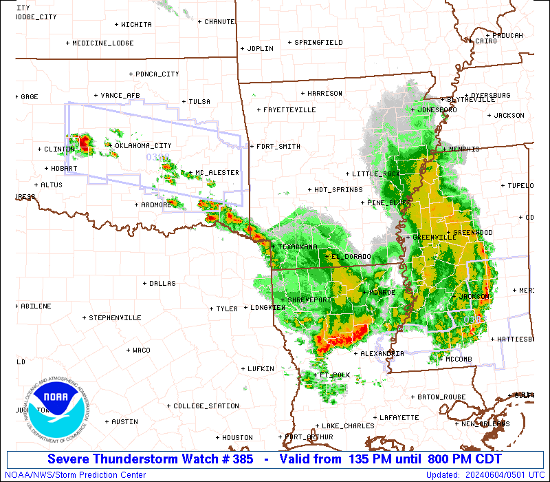
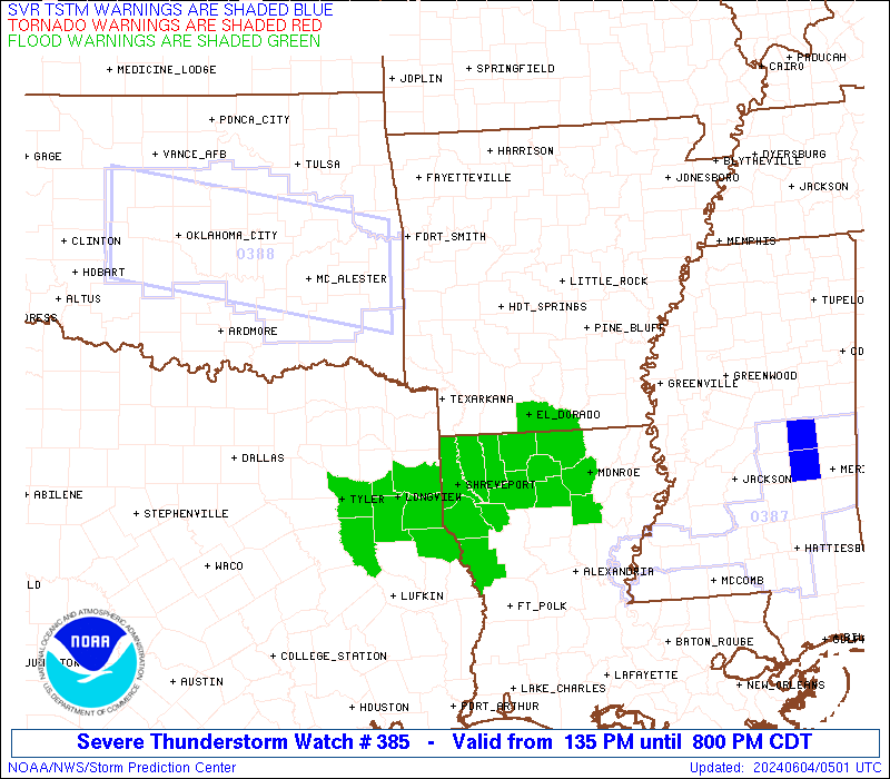
Severe Thunderstorm Watch Number 385
NWS Storm Prediction Center Norman OK
135 PM CDT Mon Jun 3 2024
The NWS Storm Prediction Center has issued a
* Severe Thunderstorm Watch for portions of
Southwest and Southern Arkansas
Northern Louisiana
Far Southeast Oklahoma
Far Northeast Texas
* Effective this Monday afternoon and evening from 135 PM until
800 PM CDT.
* Primary threats include...
Scattered large hail and isolated very large hail events to 2
inches in diameter possible
Scattered damaging wind gusts to 70 mph possible
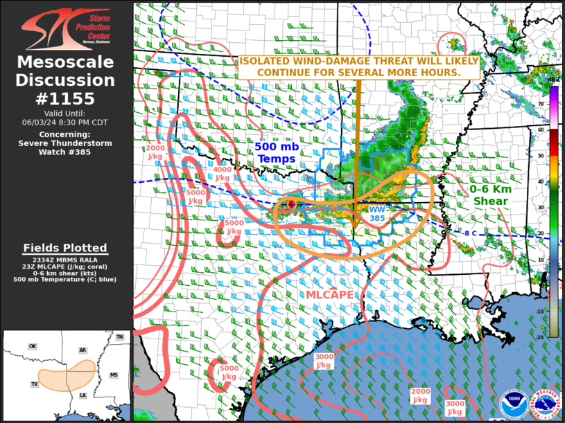
SUMMARY...A squall line will likely continue east-southeast across
the Watch area through the afternoon into the early evening. Strong
to severe gusts (50-70 mph) will be capable of wind damage with the
more intense downdrafts.
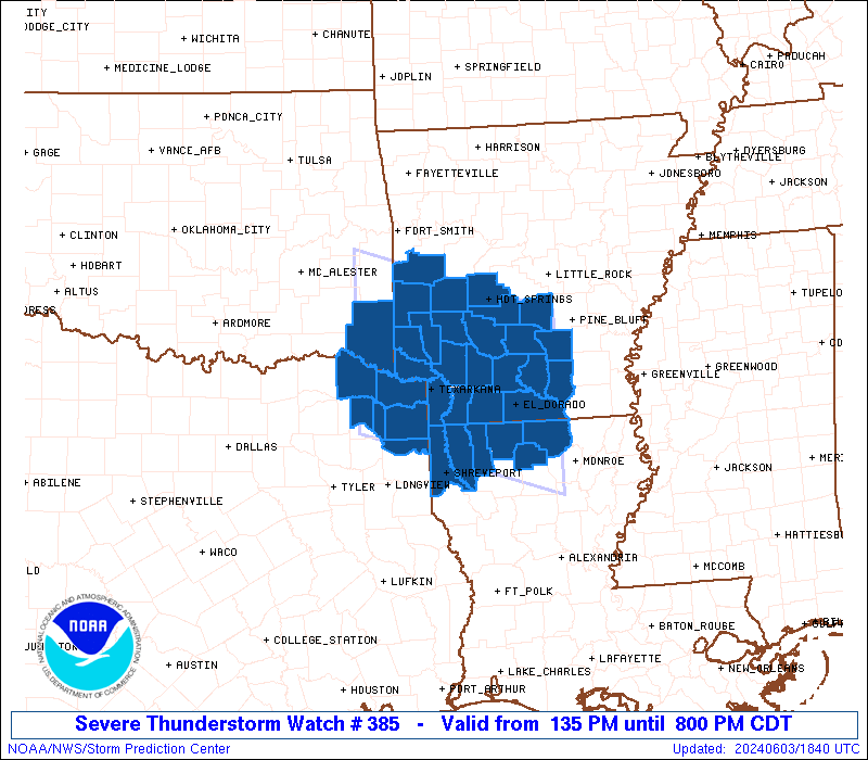
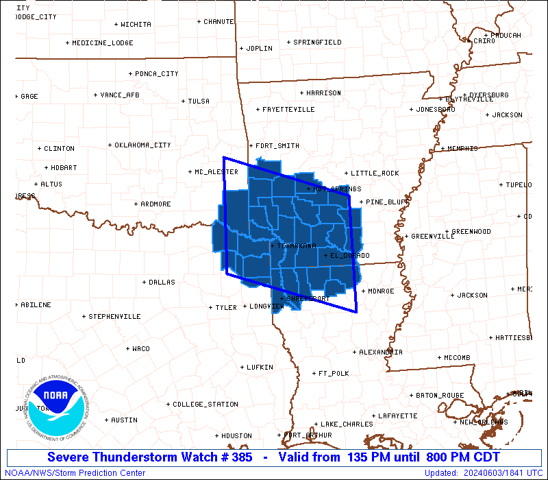
The severe thunderstorm watch area is approximately along and 75
statute miles north and south of a line from 35 miles west of De
Queen AR to 35 miles east of El Dorado AR. For a complete depiction
of the watch see the associated watch outline update (WOUS64 KWNS
WOU5).
PRECAUTIONARY/PREPAREDNESS ACTIONS...
REMEMBER...A Severe Thunderstorm Watch means conditions are
favorable for severe thunderstorms in and close to the watch area.
Persons in these areas should be on the lookout for threatening
weather conditions and listen for later statements and possible
warnings. Severe thunderstorms can and occasionally do produce
tornadoes.
&&
AVIATION...A few severe thunderstorms with hail surface and aloft to
2 inches. Extreme turbulence and surface wind gusts to 60 knots. A
few cumulonimbi with maximum tops to 500. Mean storm motion vector
29025.
...Smith
 Note:
The Aviation Watch (SAW) product is an approximation to the watch area.
The actual watch is depicted by the shaded areas.
Note:
The Aviation Watch (SAW) product is an approximation to the watch area.
The actual watch is depicted by the shaded areas.
SAW5
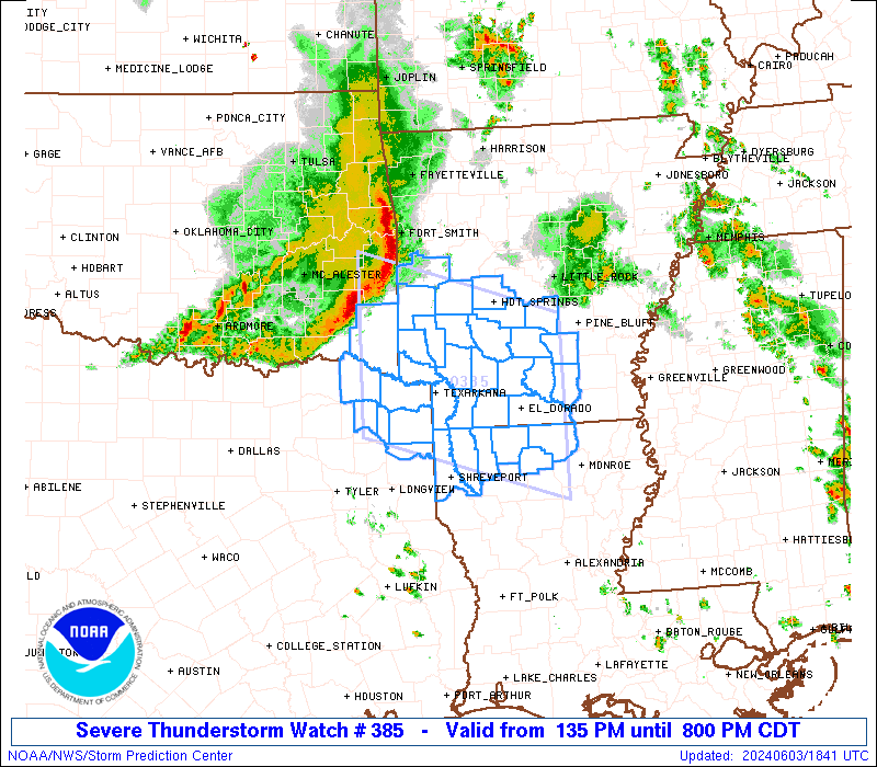
WW 385 SEVERE TSTM AR LA OK TX 031835Z - 040100Z
AXIS..75 STATUTE MILES NORTH AND SOUTH OF LINE..
35W DEQ/DE QUEEN AR/ - 35E ELD/EL DORADO AR/
..AVIATION COORDS.. 65NM N/S /57NW TXK - 27E ELD/
HAIL SURFACE AND ALOFT..2 INCHES. WIND GUSTS..60 KNOTS.
MAX TOPS TO 500. MEAN STORM MOTION VECTOR 29025.
LAT...LON 35139501 34309221 32139221 32969501
THIS IS AN APPROXIMATION TO THE WATCH AREA. FOR A
COMPLETE DEPICTION OF THE WATCH SEE WOUS64 KWNS
FOR WOU5.
Watch 385 Status Report Messages:
STATUS REPORT #1 ON WW 385

VALID 032345Z - 040040Z

SEVERE WEATHER THREAT CONTINUES RIGHT OF A LINE FROM 35 NNW GGG
TO 35 W ELD TO 25 NNE ELD TO 20 NNW PBF.

..BROYLES..06/03/24

ATTN...WFO...LZK...SHV...

&&

STATUS REPORT FOR WS 385

SEVERE WEATHER THREAT CONTINUES FOR THE FOLLOWING AREAS

ARC011-013-025-027-139-040040-

AR
.    ARKANSAS COUNTIES INCLUDED ARE

BRADLEY 	     CALHOUN		 CLEVELAND
COLUMBIA	     UNION
$$


LAC013-015-017-027-031-061-081-111-119-040040-

LA
.    LOUISIANA PARISHES INCLUDED ARE

BIENVILLE	     BOSSIER		 CADDO
CLAIBORNE	     DE SOTO		 LINCOLN
RED RIVER	     UNION		 WEBSTER
$$


TXC183-203-315-365-401-423-459-040040-

TX
.    TEXAS COUNTIES INCLUDED ARE

GREGG		     HARRISON		 MARION
PANOLA		     RUSK		 SMITH
UPSHUR
$$


THE WATCH STATUS MESSAGE IS FOR GUIDANCE PURPOSES ONLY.  PLEASE
REFER TO WATCH COUNTY NOTIFICATION STATEMENTS FOR OFFICIAL
INFORMATION ON COUNTIES...INDEPENDENT CITIES AND MARINE ZONES
CLEARED FROM SEVERE THUNDERSTORM AND TORNADO WATCHES.
$$
Note:
Click for Complete Product Text.
Tornadoes
Probability of 2 or more tornadoes
|
Low (10%)
|
Probability of 1 or more strong (EF2-EF5) tornadoes
|
Low (<2%)
|
Wind
Probability of 10 or more severe wind events
|
Mod (40%)
|
Probability of 1 or more wind events > 65 knots
|
Low (20%)
|
Hail
Probability of 10 or more severe hail events
|
Mod (40%)
|
Probability of 1 or more hailstones > 2 inches
|
Mod (30%)
|
Combined Severe Hail/Wind
Probability of 6 or more combined severe hail/wind events
|
High (70%)
|
For each watch, probabilities for particular events inside the watch
(listed above in each table) are determined by the issuing forecaster.
The "Low" category contains probability values ranging from less than 2%
to 20% (EF2-EF5 tornadoes), less than 5% to 20% (all other probabilities),
"Moderate" from 30% to 60%, and "High" from 70% to greater than 95%.
High values are bolded and lighter in color to provide awareness of
an increased threat for a particular event.


 @NWSSPC