Mesoscale Discussion 0886
NWS Storm Prediction Center Norman OK
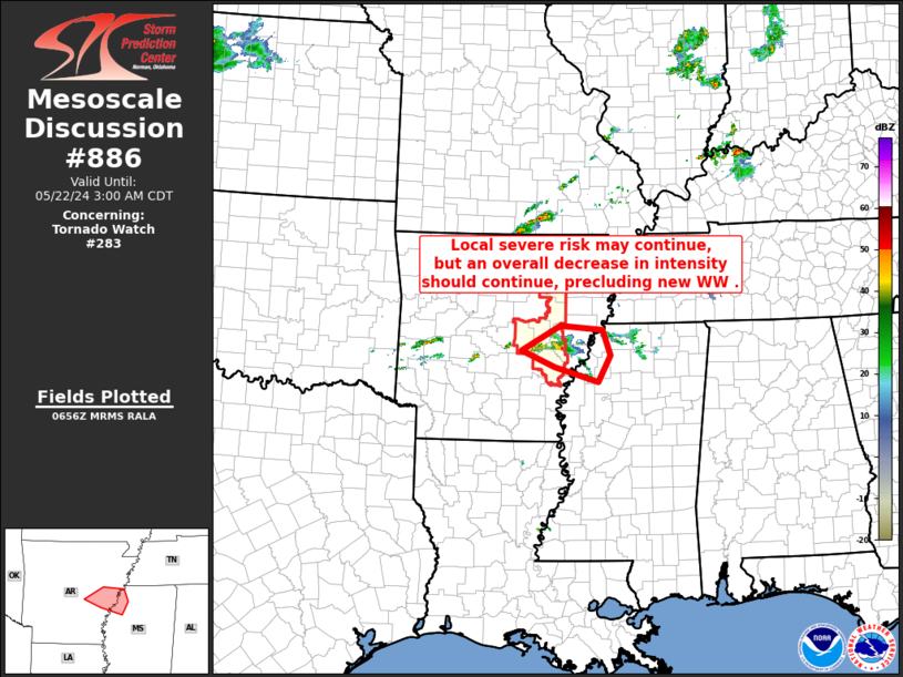
0158 AM CDT Wed May 22 2024
Areas affected...east-central Arkansas into northwestern Mississippi
Concerning...Tornado Watch 283...
Valid 220658Z - 220800Z
The severe weather threat for Tornado Watch 283 continues.
SUMMARY...As isolated convection continues to gradually decrease in
intensity, new WW is not anticipated downstream of the most
vigorous, eastern Arkansas storms.
DISCUSSION...Latest radar loop shows that the strongest storm, which
earlier exhibited supercell characteristics, continuing to gradually
decrease in intensity as it nears eastern fringes of Tornado Watch
283. While a narrow axis of mixed-layer CAPE around 1000 J/kg
exists immediately along the Mississippi River, CAPE just to the
east of the river diminishes rapidly, while at the same time capping
increases with eastward extent.
Given these factors, convective intensity is expected to continue to
gradually diminish. While there are hints in the latest HRRR runs
that weak convection developing westward as far west as southeastern
Oklahoma could locally/gradually intensify, it appears at this time
that risk will be limited/isolated, and thus not requiring WW
consideration. As such, the current watch likely to be left to
expire at 22/08Z.
..Goss.. 05/22/2024
...Please see www.spc.noaa.gov for graphic product...
ATTN...WFO...MEG...JAN...LZK...
LAT...LON 34539193 34749154 34959115 34899029 34459013 34009038
34269126 34539193
|


 @NWSSPC