Note:
The expiration time in the watch graphic is amended if the watch is
replaced, cancelled or extended.
Note:
Note:
The expiration time in the watch graphic is amended if the watch is
replaced, cancelled or extended.
Note: Click for
Watch Status Reports.
SEL3
URGENT - IMMEDIATE BROADCAST REQUESTED
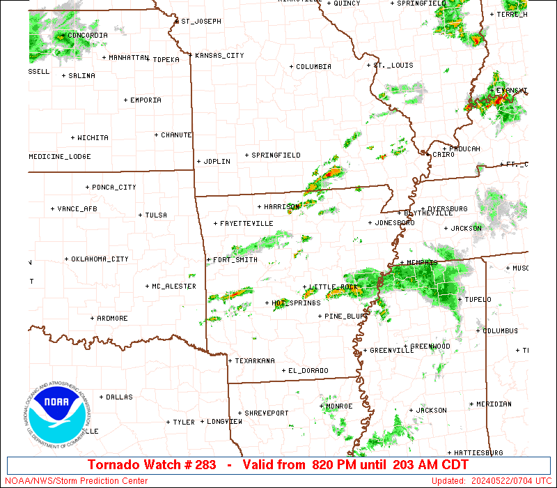
Tornado Watch Number 283
NWS Storm Prediction Center Norman OK
820 PM CDT Tue May 21 2024
The NWS Storm Prediction Center has issued a
* Tornado Watch for portions of
North cental and central Arkansas
* Effective this Tuesday night and Wednesday morning from 820 PM
until 300 AM CDT.
* Primary threats include...
A couple tornadoes possible
Scattered large hail and isolated very large hail events to 2
inches in diameter possible
Scattered damaging wind gusts to 70 mph possible
SUMMARY...A few supercells will be possible through the early
morning hours, in an environment favorable for large hail of 1-2
inches in diameter, damaging gusts of 60-70 mph, and a couple of
tornadoes.
The tornado watch area is approximately along and 70 statute miles
east and west of a line from 35 miles northeast of Flippin AR to 40
miles south southeast of Russellville AR. For a complete depiction
of the watch see the associated watch outline update (WOUS64 KWNS
WOU3).
PRECAUTIONARY/PREPAREDNESS ACTIONS...
REMEMBER...A Tornado Watch means conditions are favorable for
tornadoes and severe thunderstorms in and close to the watch
area. Persons in these areas should be on the lookout for
threatening weather conditions and listen for later statements
and possible warnings.
&&
OTHER WATCH INFORMATION...CONTINUE...WW 277...WW 278...WW
279...WW 280...WW 281...WW 282...
AVIATION...Tornadoes and a few severe thunderstorms with hail
surface and aloft to 2 inches. Extreme turbulence and surface wind
gusts to 60 knots. A few cumulonimbi with maximum tops to 550. Mean
storm motion vector 27025.
...Thompson

SEL3
URGENT - IMMEDIATE BROADCAST REQUESTED
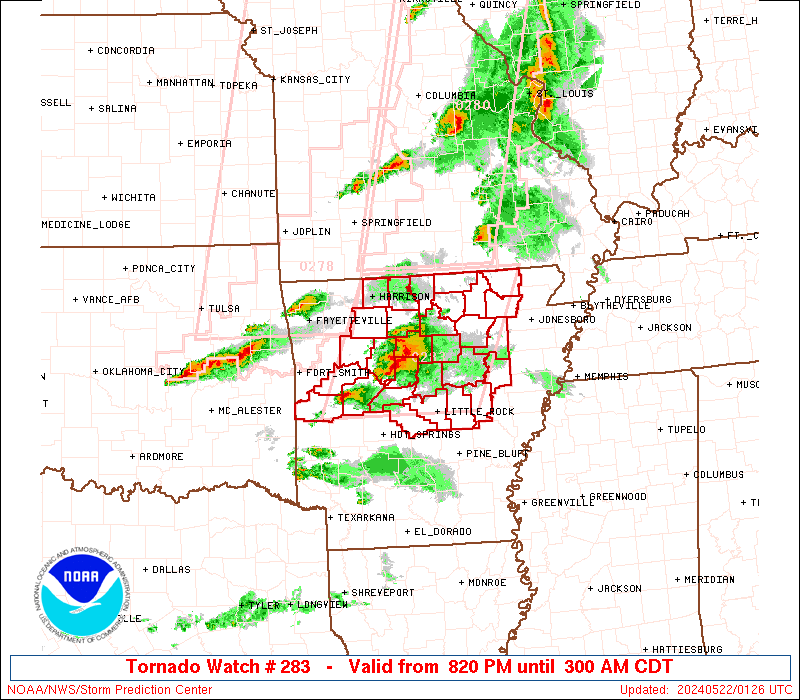
Tornado Watch Number 283
NWS Storm Prediction Center Norman OK
820 PM CDT Tue May 21 2024
The NWS Storm Prediction Center has issued a
* Tornado Watch for portions of
North cental and central Arkansas
* Effective this Tuesday night and Wednesday morning from 820 PM
until 300 AM CDT.
* Primary threats include...
A couple tornadoes possible
Scattered large hail and isolated very large hail events to 2
inches in diameter possible
Scattered damaging wind gusts to 70 mph possible
SUMMARY...A few supercells will be possible through the early
morning hours, in an environment favorable for large hail of 1-2
inches in diameter, damaging gusts of 60-70 mph, and a couple of
tornadoes.
The tornado watch area is approximately along and 70 statute miles
east and west of a line from 35 miles northeast of Flippin AR to 40
miles south southeast of Russellville AR. For a complete depiction
of the watch see the associated watch outline update (WOUS64 KWNS
WOU3).
PRECAUTIONARY/PREPAREDNESS ACTIONS...
REMEMBER...A Tornado Watch means conditions are favorable for
tornadoes and severe thunderstorms in and close to the watch
area. Persons in these areas should be on the lookout for
threatening weather conditions and listen for later statements
and possible warnings.
&&
OTHER WATCH INFORMATION...CONTINUE...WW 277...WW 278...WW
279...WW 280...WW 281...WW 282...
AVIATION...Tornadoes and a few severe thunderstorms with hail
surface and aloft to 2 inches. Extreme turbulence and surface wind
gusts to 60 knots. A few cumulonimbi with maximum tops to 550. Mean
storm motion vector 27025.
...Thompson
 Note:
The Aviation Watch (SAW) product is an approximation to the watch area.
The actual watch is depicted by the shaded areas.
Note:
The Aviation Watch (SAW) product is an approximation to the watch area.
The actual watch is depicted by the shaded areas.
SAW3
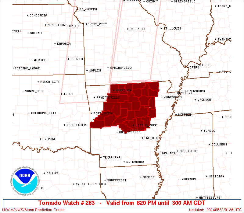
WW 283 TORNADO AR 220120Z - 220800Z
AXIS..70 STATUTE MILES EAST AND WEST OF LINE..
35NE FLP/FLIPPIN AR/ - 40SSE RUE/RUSSELLVILLE AR/
..AVIATION COORDS.. 60NM E/W /58WNW ARG - 32W LIT/
HAIL SURFACE AND ALOFT..2 INCHES. WIND GUSTS..60 KNOTS.
MAX TOPS TO 550. MEAN STORM MOTION VECTOR 27025.
LAT...LON 36559076 34719159 34719405 36559329
THIS IS AN APPROXIMATION TO THE WATCH AREA. FOR A
COMPLETE DEPICTION OF THE WATCH SEE WOUS64 KWNS
FOR WOU3.
Watch 283 Status Report Messages:
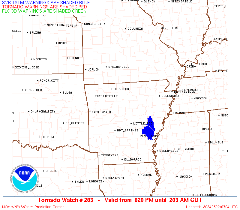
STATUS REPORT #3 ON WW 283

VALID 220600Z - 220740Z

SEVERE WEATHER THREAT CONTINUES RIGHT OF A LINE FROM 10 W LIT TO
40 ENE LIT.

..GOSS..05/22/24

ATTN...WFO...LZK...

&&

STATUS REPORT FOR WT 283

SEVERE WEATHER THREAT CONTINUES FOR THE FOLLOWING AREAS

ARC001-085-095-117-220740-

AR
.    ARKANSAS COUNTIES INCLUDED ARE

ARKANSAS	     LONOKE		 MONROE
PRAIRIE
$$


THE WATCH STATUS MESSAGE IS FOR GUIDANCE PURPOSES ONLY.  PLEASE
REFER TO WATCH COUNTY NOTIFICATION STATEMENTS FOR OFFICIAL
INFORMATION ON COUNTIES...INDEPENDENT CITIES AND MARINE ZONES
CLEARED FROM SEVERE THUNDERSTORM AND TORNADO WATCHES.
$$

STATUS REPORT #2 ON WW 283

VALID 220455Z - 220540Z

SEVERE WEATHER THREAT CONTINUES RIGHT OF A LINE FROM 25 NE HOT TO
40 ENE RUE TO 30 ESE BVX.

..KERR..05/22/24

ATTN...WFO...LZK...

&&

STATUS REPORT FOR WT 283

SEVERE WEATHER THREAT CONTINUES FOR THE FOLLOWING AREAS

ARC023-045-063-067-085-117-119-125-145-147-220540-

AR
.    ARKANSAS COUNTIES INCLUDED ARE

CLEBURNE	     FAULKNER		 INDEPENDENCE
JACKSON 	     LONOKE		 PRAIRIE
PULASKI 	     SALINE		 WHITE
WOODRUFF
$$


THE WATCH STATUS MESSAGE IS FOR GUIDANCE PURPOSES ONLY.  PLEASE
REFER TO WATCH COUNTY NOTIFICATION STATEMENTS FOR OFFICIAL
INFORMATION ON COUNTIES...INDEPENDENT CITIES AND MARINE ZONES
CLEARED FROM SEVERE THUNDERSTORM AND TORNADO WATCHES.
$$

STATUS REPORT #1 ON WW 283

VALID 220235Z - 220340Z

THE SEVERE WEATHER THREAT CONTINUES ACROSS THE ENTIRE WATCH AREA.

..KERR..05/22/24

ATTN...WFO...LZK...

&&

STATUS REPORT FOR WT 283

SEVERE WEATHER THREAT CONTINUES FOR THE FOLLOWING AREAS

ARC005-009-023-029-045-049-063-065-067-071-075-083-085-089-101-
105-115-117-119-121-125-127-129-135-137-141-145-147-149-
220340-

AR
.    ARKANSAS COUNTIES INCLUDED ARE

BAXTER		     BOONE		 CLEBURNE
CONWAY		     FAULKNER		 FULTON
INDEPENDENCE	     IZARD		 JACKSON
JOHNSON 	     LAWRENCE		 LOGAN
LONOKE		     MARION		 NEWTON
PERRY		     POPE		 PRAIRIE
PULASKI 	     RANDOLPH		 SALINE
SCOTT		     SEARCY		 SHARP
STONE		     VAN BUREN		 WHITE
WOODRUFF	     YELL
$$


THE WATCH STATUS MESSAGE IS FOR GUIDANCE PURPOSES ONLY.  PLEASE
REFER TO WATCH COUNTY NOTIFICATION STATEMENTS FOR OFFICIAL
INFORMATION ON COUNTIES...INDEPENDENT CITIES AND MARINE ZONES
CLEARED FROM SEVERE THUNDERSTORM AND TORNADO WATCHES.
$$
Note:
Click for Complete Product Text.
Tornadoes
Probability of 2 or more tornadoes
|
Mod (40%)
|
Probability of 1 or more strong (EF2-EF5) tornadoes
|
Low (20%)
|
Wind
Probability of 10 or more severe wind events
|
Mod (40%)
|
Probability of 1 or more wind events > 65 knots
|
Low (20%)
|
Hail
Probability of 10 or more severe hail events
|
Mod (40%)
|
Probability of 1 or more hailstones > 2 inches
|
Mod (30%)
|
Combined Severe Hail/Wind
Probability of 6 or more combined severe hail/wind events
|
High (70%)
|
For each watch, probabilities for particular events inside the watch
(listed above in each table) are determined by the issuing forecaster.
The "Low" category contains probability values ranging from less than 2%
to 20% (EF2-EF5 tornadoes), less than 5% to 20% (all other probabilities),
"Moderate" from 30% to 60%, and "High" from 70% to greater than 95%.
High values are bolded and lighter in color to provide awareness of
an increased threat for a particular event.


 @NWSSPC